Azimuthal Equidistant
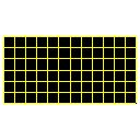
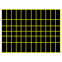
Equirectangular
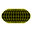
Hammer
Lambert Azimuthal Equal-Area
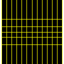
Mercator
Miller Cylindrical
Mollweide
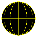
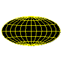
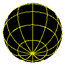
Orthographic (0 lat)
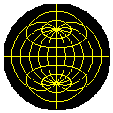
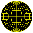
Orthographic (45 lat)
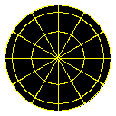
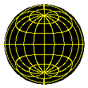
Orthographic (90 lat)
Sinusoidal
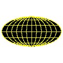
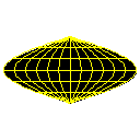
Van Der Grinten
Wagner IV
Click on picture to download zip file.
All grids are based on a 25000-mile circumference
world. On most projections, a simple scale bar does not have real meaning
because
the distances are distorted based on where the on the
map a distance is measured.
These files were produced with a few mouse clicks
using the Fractal Terrains software, soon to be released from ProFantasy.
|
Azimuthal Equidistant |
Equirectangular |
Hammer |
|
Lambert Azimuthal Equal-Area |
Mercator |
Miller Cylindrical |
|
Mollweide |
Orthographic (0 lat) |
Orthographic (45 lat) |
|
Orthographic (90 lat) |
Sinusoidal |
Van Der Grinten |
|
Wagner IV |
||